Suche
SUCHE: Unternehmen
GPS - Suche / Anzeige
| DMS: | |
| DM: | |
| DEG: | |
| POS: |
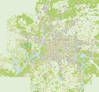
Übersichtskarte
Stadtplan fredersdorf
holteistraße fredersdorf
15370 fredersdorf
Die Berliner Karte ist jetzt hochauflösend in den Zoomstufen 150 und 200 verfügbar. Und als Mobile Version
Regionales
Brahmsstraße
Braunschweiger Straße
Brunhildstraße
Dietrichstraße
Eichendorffstraße
Freiligrathstraße
Giselherstraße
Gunterstraße
Güstrower Straße
Halbe Straße
Hans-Sachs-Straße
Haydnstraße
Hebbelstraße
Hermann-Löns-Straße
Holteistraße
Kretzerstraße
Lisztstraße
Lortzingstraße
Martin-Luther-Straße
Müllerstraße
Nibelungenring
Parchimer Straße
Röntgenstraße
Rostocker Straße
Rügenstraße
Schubertstraße
Schweriner Straße
Siegfriedring
Rubriken
