
Suche
SUCHE: Unternehmen
GPS - Suche / Anzeige
| DMS: | |
| DM: | |
| DEG: | |
| POS: |
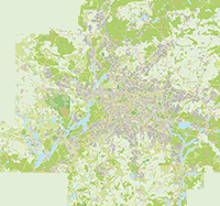
Übersichtskarte
Stadtplan Berlin - Waidmannslust
Dianastraße Berlin
13469 Berlin - Waidmannslust
Bezirk Reinickendorf
Die Berliner Karte ist jetzt hochaufl�send in den Zoomstufen 150 und 200 verf�gbar. Und als Mobile Version
Regionales
Straße / Platz (42)
Ackerplanweg
Allmendeweg
Am Ansitz
Am Dianaplatz
Am Leitbruch
Am Packereigraben
Am Wechsel
Antonyplatz
Avenue Charles de Gaulle . .
Bondickstraße
Dianaplatz
Dianastraße . .
Dünenweg
Egidystraße . .
Feldmarkweg
Fließtalstraße
Florastraße
Freilandweg
Fürst-Bismarck-Straße . .
Halalistraße . .
Hochjagdstraße
Hubertusstraße . .
Jagowstraße
Jean-Jaurès-Straße . .
Marie-Schlei-Platz . .
Moränenweg
Nach der Höhe . .
Neulandweg
Nimrodstraße
Place Moliére . .
Rosentreterpromenade
Rue Diderot . .
Rue Lamartine
Rue Montesquieu . .
Rue Racine . .
Schollenhof
Schollenweg
Steilpfad
Talsandweg
Treiberpfad
Waidmannsluster Damm . .
Waldhornstraße
Rubriken